
Real Estate & Property Law
4 August 2026
Wayleaves and Public Rights of Way in Kenya: Landowner Rights and Compensation
By Christopher N. Rosana
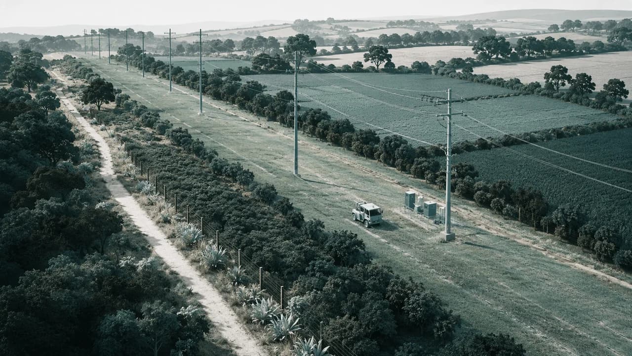
Utility infrastructure, public paths and access corridors sometimes need to cross privately occupied land. That does not make the land freely available for construction or entry. Kenyan law provides a public-rights framework for creating and administering these rights, including notice to affected people, a defined route, opportunities to make representations, and compensation where the law requires it.
The most important first step is to identify the right being proposed. A wayleave is not the same as a private easement between neighbours, an access order for landlocked property or an informal permission to enter. The purpose, holder, route, permitted works and process determine both the owner’s obligations and the applicant’s limits.
Know whether the proposal is a wayleave or a communal right of way
Part X of the Land Act, 2012 allows the National Land Commission to create a public right of way. Section 143 describes two forms. A wayleave is created for the benefit of the national or county government, a local authority, public authority or corporate body so that it can perform its functions. A communal right of way is created for the benefit of the public.
The difference is practical. A wayleave may allow the authorised organisation’s employees, agents and contractors to enter land, undertake works, construct and maintain installations or structures, and pass and repass in connection with that organisation’s purpose. It is not a general licence for unrelated activity or an unlimited right to occupy the land. A communal right of way entitles the public to pass and repass, and may permit recreational or other prescribed activity in an area designated for that purpose.
Once created, a public right of way attaches to and runs with the servient land. It can bind successive owners and is not defeated merely because the land is held under a different tenure or customary arrangement. That is why an owner, buyer or lender should check the register, the creating order, route plan and the actual site rather than relying solely on a fence line or local understanding.
Creation begins with a defined purpose, route and affected people
A State department, county government, public authority or corporate body may apply to the National Land Commission for a wayleave. The Commission may also initiate creation in the circumstances provided by the Act. The application should be specific enough for affected people to understand what is proposed: the land, route, nature and purpose of the right, installations or works, and the persons expected to use it.
Route definition is not a formality. A utility corridor can affect homes, crops, drainage, access, livestock, security, future development and a lender’s valuation. Before responding to a proposal, an owner or occupier should assemble the title and current search, survey or mutation records, site photographs, details of buildings and crops, existing services, tenancy or occupation information, and evidence of the land’s actual use. A precise alternative route or mitigation proposal is usually more useful than a general objection.
Section 144 requires the proposed right to be brought to the attention of affected people. Notices are directed to occupiers of the land, including persons using it under customary pastoral rights; the relevant county government; actual occupiers of urban or peri-urban land; and other interested people along the route or using the land likely to be affected. An applicant should not assume that a registered owner is the only person with a relevant interest. An occupier should not ignore a notice simply because they are not named on the title.
Notice, objections and local participation are part of the process
After at least thirty days from service of the notices, the Commission considers the information, objections and representations received. Under section 145, it may recommend a public inquiry, seek the county government’s opinion, or facilitate negotiations between the applicant and people who made representations. This creates a real opportunity to address route changes, construction impacts, timing, access to the remaining land, restoration, compensation evidence and protective conditions before the right is finalised.
Prepare a written response that identifies the parcel and interest, the part of the proposal contested, factual impacts and supporting documents. Where the concern is loss of a house, trees, crops, a business entrance or a borehole, record the condition before entry and explain the likely impact. If the proposal interferes with a planned development or an existing easement, supply the relevant approvals, plans and instruments. Unsupported claims or a refusal to engage can make it harder to resolve an avoidable dispute.
A public inquiry may be appropriate where representations require fuller consideration. The Cabinet Secretary decides whether to create the right after considering the Commission’s recommendations, county-government advice and negotiation outcomes. If a right is created, the order may contain amendments, limitations and conditions, including construction and maintenance-cost conditions. Its route must be delineated, it must be gazetted, communicated to the county government and publicised to people occupying and using land along the route. It comes into force thirty days after publication in the Gazette.
The final order and register entry matter as much as the consultation. After the statutory appeal period, the route is registered in the land register and on the relevant title or lease record. Before construction, an applicant should compare the Gazette order, registered route and site plan so that surveyors and contractors are working within the right actually created. An owner should obtain those records before assuming that a preliminary proposal, a notice of intention or an old informal track has already become a binding public right.
A person who made representations or objections may appeal the Cabinet Secretary’s decision to the court on a point of law within the period set by section 146. The question should be identified carefully at once and dealt with promptly; a complaint about valuation, route evidence, notice, statutory authority or the terms of the final order may require different evidence and remedies. The existence of a proposed or disputed wayleave does not make unilateral obstruction, demolition or relocation a safe response. Preserve documents and seek advice before any irreversible step.
Compensation should be evidenced and tied to the actual impact
The applicant for a public right of way must promptly compensate the owner of land over which it is created. The Act includes loss or damage caused by preliminary surveying or route-determination work, whether or not the affected trees, crops or buildings ultimately fall within the delineated route. Compensation is therefore not limited to the final strip shown on a plan. It should reflect evidence of the particular lawful interest and loss caused.
Owners and occupiers should retain dated photographs, crop or tree records, tenancy information, valuation material, construction logs, correspondence, notices and records of entry. Where damage is alleged, document the condition as soon as possible and distinguish pre-existing deterioration from work-related loss. An organisation proposing the right should keep route surveys, notices, service records, assessments, compensation offers, payment records and work specifications. A transparent record supports fair resolution and is also valuable when the land changes hands.
Compensation does not automatically enlarge the holder’s right. The right remains confined to the route, purpose and terms of the creating order. A change in route, new installation, materially more intensive use or damage beyond agreed works should be documented and addressed under the applicable process. Equally, an owner should not obstruct a properly created public right simply because the use is inconvenient or compensation is disputed; urgent professional advice may be needed to protect the position lawfully.
Enforcement and court powers depend on the right’s actual terms
Where a person wrongfully obstructs or encroaches on a public right of way, section 148 permits the Commission to require rectification by written notice. The notice is ordinarily for fourteen days, and the recipient can ask the Commission to reconsider it within that period. If reconsideration is refused, an appeal to the court is available. A gate, fence, wall, building, crop or private use should therefore be assessed against the actual route and order before any action is taken.
Section 149 gives the court broad powers to resolve disputes about the existence, enforceability or permitted extent of an easement, analogous right or public right of way. It may address required works, reasonable costs, allocation of costs, timing and the entry needed to carry out work. The remedy will turn on the creating instrument or order, register, Gazette record, site evidence, notices and conduct of the parties—not on who has the louder claim to the route.
For a buyer, the due-diligence question is not just “is there a wayleave?” Obtain the public-right-of-way documents, inspect the route, identify the holder and permitted activity, check compensation and outstanding works, and assess how the corridor affects use, development and finance. For an affected owner or occupier, act early: keep the notices, submit focused evidence, identify realistic mitigation and do not rely on informal assurances. A clearly created and managed right can support essential public infrastructure while respecting the land and people it crosses.
Primary source: Land Act, 2012, sections 143–149.
Part 39 of 42 in this series.